About our Drone Surveys Excellence
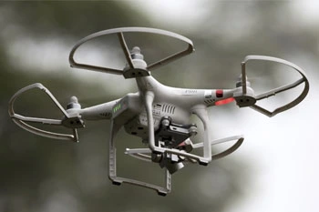
Aerial drone surveying uses sophisticated UAVs equipped with advanced cameras and sensors (including LiDAR) to capture highly accurate topographic and visual data. This modern approach is faster, safer, and often more cost-effective for large-scale or inaccessible projects.
The Visionland Process
Flight planning and airspace check
We coordinate with aviation authorities and map out precise flight paths to ensure safe, legal, and thorough coverage.
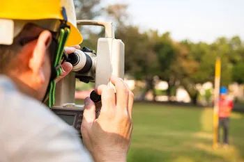
Ground control point setup
Highly accurate GPS markers are placed on the ground to calibrate the drone data for sub-centimeter precision.
Autonomous drone flight and data capture
Advanced UAVs capture thousands of high-resolution images and LiDAR points covering every inch of the project site.
Photogrammetry processing and delivery
Our specialists process the raw data into detailed 3D models, orthomosaics, and topographic maps for your use.
Need a Drone Surveys for your project?
Ready to provide the precision data your project needs. We respond to all requests within 1 hour.
Order Your SurveyCall Support
Available Mon-Fri

Start Your Project
We respond to all requests within 1 hour during business hours. Secure, transparent estimates without the wait.
MAITLAND FLORIDA 32794