About our Elevation Certificates Excellence
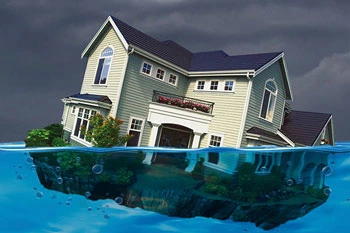
Required for properties located in high-risk flood zones, an Elevation Certificate precisely compares the lowest floor of a building to the Base Flood Elevation calculated by FEMA. This document is critical for securing flood insurance and building permits.
The Visionland Process
Review of current FEMA FIRM maps
We analyze the latest Flood Insurance Rate Maps to determine your property's designated flood risk zone.
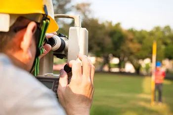
High-precision elevation field measurement
Our team measures the lowest floor and adjacent grades with precision instruments to compare against flood levels.
Documentation of building mechanics and vents
We record essential building details like machine heights and flood openings required for the official FEMA form.
Preparation of the official FEMA form
A certified Elevation Certificate is completed and provided for your insurance agent or building department.
Need a Elevation Certificates for your project?
Ready to provide the precision data your project needs. We respond to all requests within 1 hour.
Order Your SurveyCall Support
Available Mon-Fri

Start Your Project
We respond to all requests within 1 hour during business hours. Secure, transparent estimates without the wait.
MAITLAND FLORIDA 32794