About our Flood Zone Determination Excellence
We determine exactly where your property lies in relation to FEMA established flood zones. If we find that a structure is actually on natural high ground, we can assist in filing a Letter of Map Amendment (LOMA) to have the flood insurance requirement officially removed.
The Visionland Process
Reviewing local and national flood data
We cross-reference historical flood records with current FEMA maps and local drainage studies.
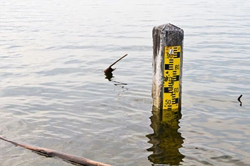
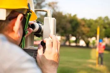
Surveying ground elevations on site
Extensive on-site measurements are taken to map the natural highs and lows of the property terrain.
Comparing data to base flood elevations
We determine exactly how much of your property sits above or below the calculated flood risk levels.
Filing applications with FEMA if applicable
If your structure is on high ground, we assist in applying for a LOMA to remove the flood insurance requirement.
Need a Flood Zone Determination for your project?
Ready to provide the precision data your project needs. We respond to all requests within 1 hour.
Order Your SurveyCall Support
Available Mon-Fri

Start Your Project
We respond to all requests within 1 hour during business hours. Secure, transparent estimates without the wait.
MAITLAND FLORIDA 32794